| Home page | Bellringing | Talks & lectures | Fell walking | Settle - Carlisle | Metal sculpture | Brickwork | Journeys | Ergonomics | The rest | Site map |
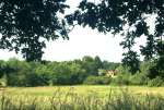
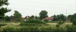
Just to the south of Wokingham, the other side of the railway line, is some very attractive countryside. I have regularly walked there since the 1960s. (See also some early pictures of the area and pictures of Gorrick Wood ).
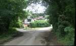
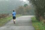
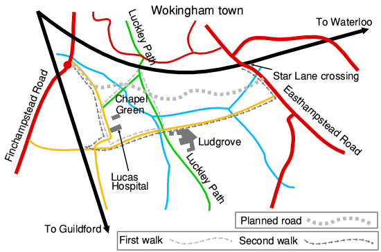
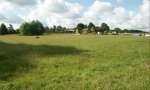
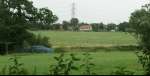
In July 2008 I took my camera on two walks, to record an area that was under threat of being covered with houses and a main road. The first was my usual walk around Chapel Green, starting and ending at the footbridge over the railway. The second was a longer walk from Finchampstead Road, ending at Star Lane crossing on Easthampstead Road (see map below).
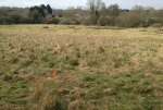
A few years later another development proposal for Chapel Green was successfully defeated. But then the Council planned to designate this whole swathe of open country as a Strategic Development Location, and despite huge opposition the planning inspector approved the plans. The indicative route of the road is shown on the map below, and much of the land either side will be covered with houses.
When this area is built over, we will lose a well loved natural amenity (quite apart from the wider effect on the town of yet more over-development ). Future generations will not be able to enjoy what we have enjoyed since much of this lovely stretch of countryside will be lost under brick and tarmac, with no way of bringing it back. Some green space will remain between the houses and roads, but that cannot replace the tranquility that is there now.
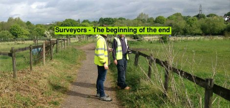
As a reminder of what is to come, in May 2017 I came across a couple of surveyors near Chapel Green during my morning walk. They were only doing their job, but they signal the beginning of the end for this beautiful stretch of countryside. Where they are standing will be a street surrounded by houses, with the main road and a roundabout in front of the trees. Enjoy what is there now in the little time that remains. And after it has been changed I hope you will continue to enjoy these pictures.
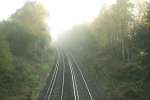
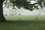
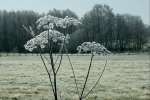
My original walks were in the summer, but the area is beautiful all year round. I well remember the autumn day when I read the sad news that the planning inspector had sealed its fate. The sun, combined with mist hanging above the ground made the area look especially peaceful.
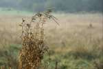
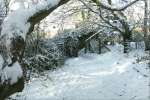
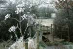
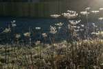
Over the years I seen the area under heavy snow and in heavy frost (which highlighted the delicacy of the foliage). I saw the removal of trees to open up the area where the main path crosses the stream, and later extensive work to improve the paths (some of which deteriorated the following year). There is always something interesting to see as the landscape and wildlife evolves.
I hope you enjoy the pictures of this unspoilt part of Wokingham before it was lost to development.
Each group has a brief description and a set of thumbnails. Click on any thumbnail to see the full size picture.
You can use the arrows to move between pictures, or return to the main page.
Use the links below if you are interested in a particular section or just start at the beginning .
| First walk | Second walk | Other walks | Later pictures |
All material and pictures © 2008 to 2019 John Harrison
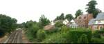
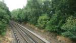
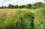
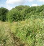
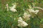
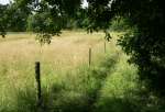
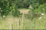
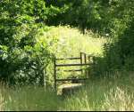
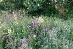
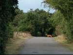
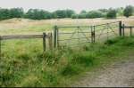
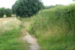
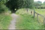
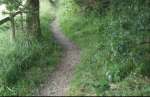
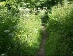
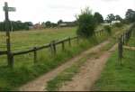
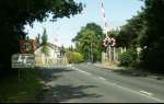
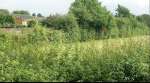
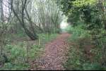
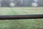
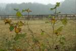
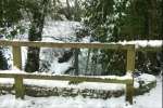
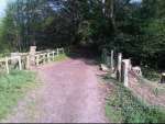
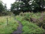
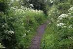
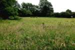
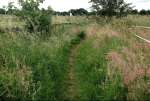
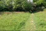
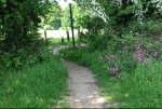
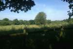
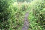
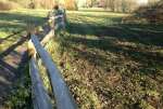
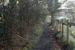
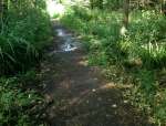
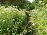
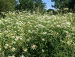
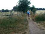
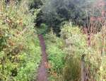
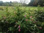
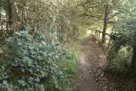
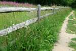
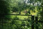
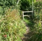
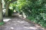
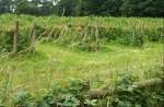
The walk starts on the footbridge where Luckley Path crosses the railway to Waterloo. For over a century, the railway has marked the boundary between the town and the countryside here. Stand on the footbridge and look along the track, as well as out towards open country (though the trees next to the railway hide much of it from here. Over the footbridge Luckley Path continues south, but leave the main path and climb over a stile. A shady path leads down through the trees. It emerges amid luxuriant grass, with open ground on the left, and overgrown land between the path and the railway on the right. Wild flowers abound if you stop to look at them. When the path reaches the Emm Brook, there is a stile at either end of the bridge.
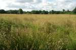
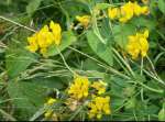
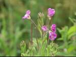
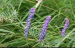
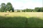
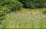
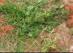
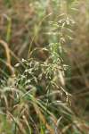
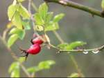
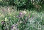
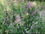
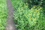
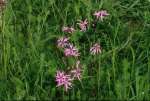
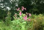
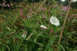
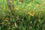
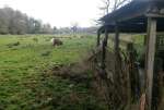
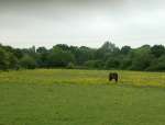
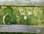
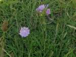
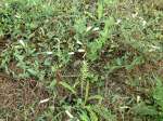
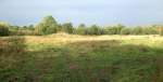
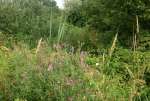
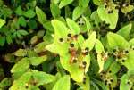
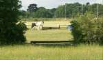
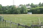
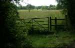
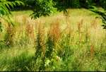
Past the stream, the path goes through the meadows of Chapel Green Farm where horses graze. Look among the meadow grass, and you will see many other plants growing as well.
 Horse and jumps |
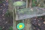
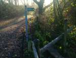
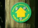 Footbapth sign |
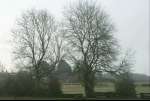
 Chapel Green farm |
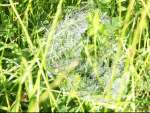 Dew on cobweb in the grass |
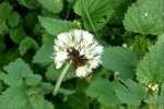
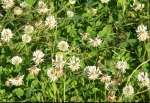 White clover |
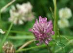 Purple clover |
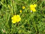 Buttercups |
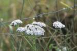
 Scabius |
 Colts foot |
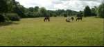 More horses grazing |
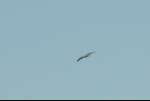
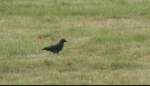 A scavanging crow |
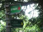
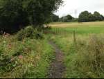
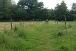
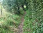
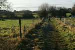
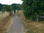
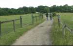
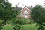
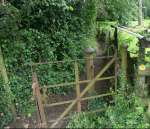
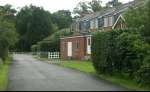
Here you meet a cart track that is well used in all weathers by people tending horses, as well as people out strolling, since it is part of an easily walked circuit from Finchampstead Road. Past the farm, the track is metalled as it passes Lucas Hospital. Where it turns right, take the style straight ahead towards Ludgrove Lane.
 Footpath signs by the lane |
 Towards the town |
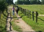
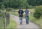 Boys strolling |
 Gipsy Lane behind the trees |
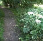
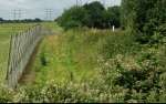
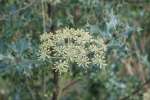
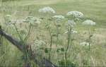 Hemlock growing by the fence |
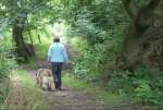
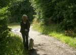
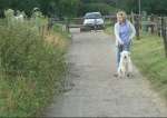 Walking the dog |
 Leading a horse |
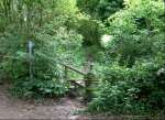
 The stile by Lucas Hospital |
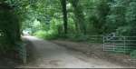
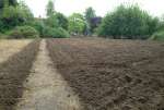
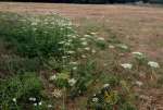
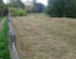
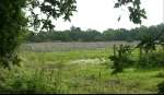
You approach Ludgrove Lane along a path through the field in front of Lucas Hospital. Some years ago the meadow was ploughed to encourage wild flowers. By 2008 (early pictures) many were flourishing and by 2015 the whole area was a riot of colour (later pictures).
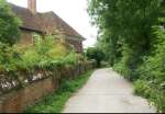
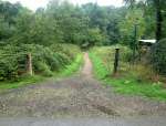
After the meadow turn left along the lane, which is a tarmac drive giving access to both Ludgrove Farm and Ludgrove School. You can walk or cycle along it from Finchampstead Road to Easthampstead Road, but a gate in the middle ensures that vehicles only use it for access. This first walk follows it for a short way, almost as far as the farm.
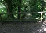
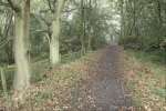
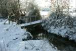
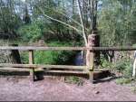
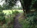
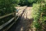
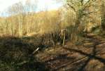
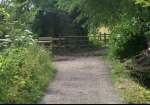
Just before the farm, the lane meets Luckley Path, an ancient route that runs from near Wokingham Market Place to Gorrick Wood, north of Crowthorne. After crossing Ludgrove Lane it heads south, past the school and the market gardens, and into the forest, but we turn left and head back along it towards the footbridge over the railway where we began. The path crosses the Emm Brook, on a bridge that is good for children playing 'Pooh sticks'.
[Update spring 2011] The trees next to the bridge have been felled to protect the structure, giving the bridge a very different feel, see pictures .
The first walk of just over a mile, takes you around only a small part of the area under threat to the south of Wokingham. The longer walk from Finchampstead Road through to Easthampstead Road is shown below.
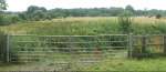
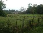
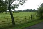
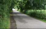
Walk down Finchampstead Road, over the Emm Brook, and take the lane on the left, just before the roundabout. You soon leave the sound of traffic behind. Passing through the gate, there are views of fields to your left. Then the lane turns sharp right by some stables.
 Leaving Finchampstead Road |
 Gate across the lane |
 Northeast towards the town |
 Sorrel growing in the field |
 Morning walk |
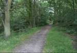
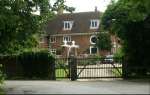
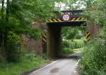
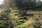
The lane turns into a track between fences. Camomile growing in the track contrasts with the red brick hard core. You join the route of the first walk and pass alongside Lucas Hospital. The lane turns sharp right where you can pause to look briefly into the garden. You meet Ludgrove Lane by a house restored and extended some years ago. A few yards to the west is the narrow bridge under the Guildford railway line. More or less opposite you is the broad track heading south towards Gorrick Wood.
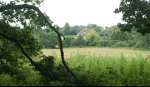
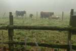
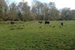
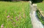
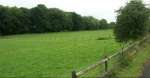
Walk east along Ludgrove Lane, joining the route of the first walk as you pass in front of Lucas Hospital. Whereas on the first walk, the views were all north towards the town, on this walk, we look south, across pasture land.
 Lucas Hospital from Ludgrove Lane |
 Looking southwest |
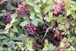
 Blackberries in flower |
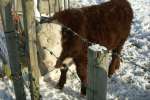
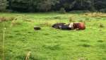
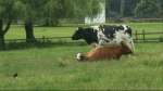 Cows and calf |
 Bullock feeding |
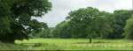
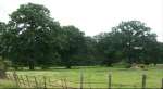 Majestic oak trees |
 Looking southeast |
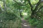
 Where Luckley path goes south |
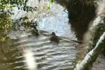
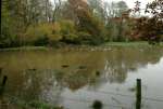
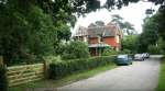
Go straight on where the first walk turned left, and you pass Ludgrove School and Farm. The accommodation next to the lane was converted some years ago from farm buildings. To your left, the broad sweep of pasture continues to the east. Just beyond the school is the duck pond. It is surrounded by trees. Thirty years ago, I remember it freezing over, and the boys from the school skating on it, but normally only the ducks are there.
 Student accommodation |
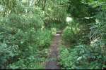
 Trees along the Emm Brook |
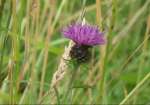
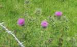 Thistle flowers |
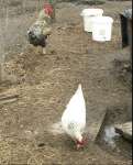 Hens at Ludgrove |
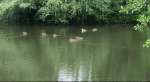
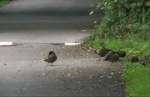 Ducks on the road |
 Taking to the water |
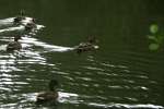 Leaving wakes |
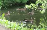
 View across the pond |
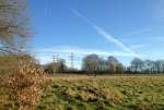
The eastern part of Ludgrove Lane has fewer 'chocolate box' views, with more evidence of working agriculture, and fields full of raspberries, cabbages or pens for rearing game birds, but there is still plenty of interest to see as you walk along, with views across the fields, and several glimpses of Star Lane crossing in the distance. At the end of the lane is an attractive old house.
 Across to Star Lane crossing |
 Looking back northwest |
 Past the duckpond |
 Fields of raspberries |
 Game bird pens |
 Cabbages and flowers |
 View towards the town |
 Houses by Star Lane crossing |
 The end of the lane |
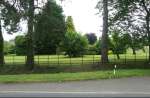
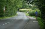
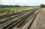
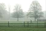
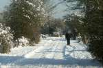
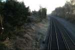
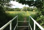
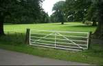
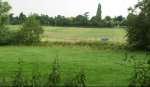
Turn left on the road, but before you do so, admire the parkland on the other side. As you walk along, you get views of the open land to west and east through the gaps in the hedges. Look closely for detail as well. The road rises as you approach Star Lane crossing, allowing you final views of open country to the east and west. Cross the railway and look back towards the green fields that might not be there in future.
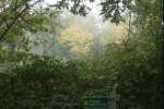
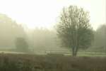
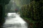
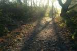
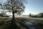
I was walking down from the railway bridge to the bridge over the Emm Brook early in the morning before starting work, and although I hadn't intended to take pictures, the view was so stunning that I took a couple using my phone camera.
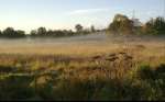 Mist lying over the meadow |
 Horse peacefully grazing |
A few days later, armed with a 'proper' camera, I went to take some pictures. The landscape was beautiful even without much sun, and there was much detail to look at, even though it was long past the flower season. I followed the same route (the first of the summer walks). The pictures below are in order, but I haven't broken them up into sections, like the summer walk.
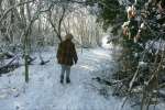
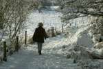
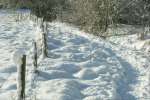
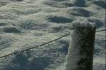
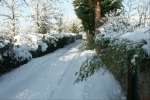
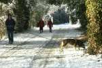
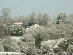
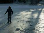
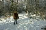
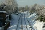
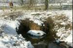
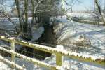
This area looks beautiful in winter as well. On the first morning after the big snow in January, I went for a walk, along with scores of others to judge by the extent to which the snow was trampled along the paths.
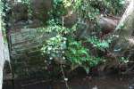
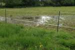
On the winter walk, I took particular note each time we crossed the Emm Brook. A couple of weeks earlier it was in flood as the pre-Christmas snow melted, and the south eastern tributary was heavily polluted – covered from bank to bank with diesel for several days. On this occasion, things looked more or less normal.
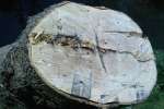
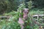
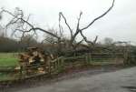
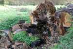
In April, several trees were felled by the 'Pooh sticks bridge' on Luckley Path. What used to be a shady spot is now open to the full sun. Only the trees close to the bridge were felled, so I assume they were cut down to protect the bridge structure. Damage done by the tree roots the the abutment walls are clearly visible.
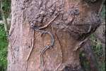
One of the cuts shows barbed wire deep within the trunk, which must have been growing around it for years. It's not clear whether the chain saw cut through the barbed wire, or had a lucky escape.
The trees were not cut down to the ground, but left as stumps a few feet tall. By the summer, fresh growth was sprouting from these stumps.
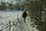
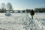
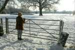
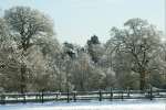
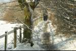
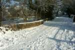
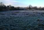
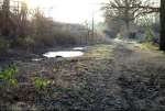
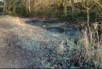
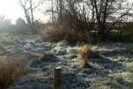
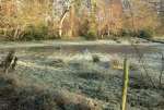
After a hard frost the previous night, everything was covered in white, and looked beautiful in the sunshine on my morning walk. The next day I took a camera with me. It wasn't sunny, so the pictures are more muted, but things looked beautiful despite the more subdued tones. The route I took is the same as the original first walk.
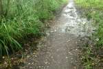
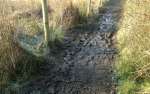
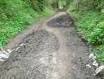
By 2013 both Luckley Path and the path SW from the railway were suffering seriously with many patches turning into deep mud. Standing water near the paths made it clear that the drainage was inadequate. In June 2014 a lot of stone rubble was spread on top of the mud. In the least bad areas this may prove effective but within days the stones were starting to sink into the mud in the worst areas. The depth of the mud is clear from the picture of the dump truck sunk up to its axle – in June! The only attention to drainage seems to be the addition of one small drain on Luckley Path.
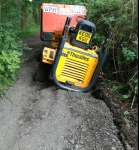 Dumper sunk in deep mud after spreading stones – June 2014 |
These pictures were taken on various walks. They illustrate the continuing variety and beauty of the area and seeing the deer was a lucky break. The recent work on the path from the railway bridge down to the style over the Embrook was long overdue and very welcome. No longer do you need to squelch through the mud or duck under the overhanging trees.
The next four pictures were taken on a frosty day early in 2016. The following two were taken in late spring after the ground had mostly dried out, showing how some stretches of the path that were improved last year have already deteriorated, with the newly laid rubble swallowed by the mud. In other places the less trodden edges of the rubble are already being colonised by flowers. The other pictures were taken in May and June when the area was as beautiful as ever but for how long?
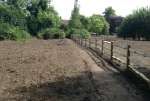
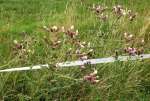
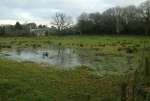
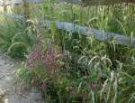
The winter of 2016-7 was mild, with some attractive misty scenes. The dry spring was followd by a wet May, which left the low lying meadow under water. May also saw the field in front of Lucas Hospital ploughed up., with a rustic fence erected to separate most of it from the public path. The field had been full of wild flowers since the original pasture was ploughed and re-seeded around 15 years earlier,
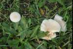
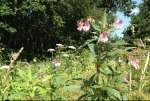
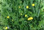
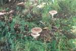
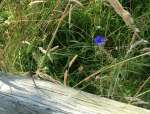
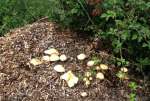
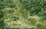
Summer brought the usual crop of wild flowers, in all their diversity, along the paths and around the fields, with fungi starting to appear in August.
The path from the railway down to the stream, which was so much improved after the Council installed drainage under the path and built it up with rubble, has deteriorated significantly this year. Some of the drainage has become blocked, forcing the spring water to run over the path, with subsequent build up of mud on the surface.
In December some of the overhanging trees were cut back, by this path and the main Luckley Path.
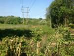
A mysterious blue pipe appeared in one field, with a red flag not far away, maybe related to the plans to build on this area. Trees were pruned next to Luckley Path where it goes under the power lines. Even in July some of the renovated paths have reverted to mud were still wet. One of the drains under the path running SW from the railway is much smaller than the other and had become blocked, with ground water running across the path even in the driest weather. However, a few minutes with a drain rod cleared the roots blocking it and it now works again.
Wild flowers abounded, especially in the meadow by Lucas Hospital, which was re-seeded last year. There was a long drought in the summer, and as it progressed, plants resistant enough to remain green showed up against the parched grass. Green quickly returned after the drought ended, and before long was succeeded by the start of autumn colours.
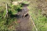
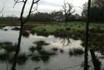
Another blue pipe appeared (obviously to monitor ground water ahead of the development) as well as a bright red stake near where the road will cut through. No pipe needed to detect the flooding in June though when the river rose a couple of feet and submerged the paths on either side of the bridge. Meanwhile the cycle of life continued with abundent green and wild flowers progressing through the summer to the autumn.
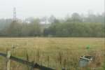
The in January the flooding around the Emm Brook was even worse than it is in most years. The water level rose and spread along the path, leaving the bridge as an 'island'. After a few more days heavy rain it rose even further – over two feet higher than its normal level, and several inches above the surface of the bridges. A large area around the stream was flooded with the path in both directions too deep to wade. The new road will go over here – on a 5m embankment, and in the summer another hole was bored to monito the soild conditions. Also near the route an area in the middle of a field was rotavated to create a mysterious patch of rejuvenated grass.
Spring saw the start of the CoViD-19 epidemic, with more people walking for exercise, but preparations for the new road continued with test boring near where it will cross the Emm Brook. Nature also continued with prolific growth everywhere – for now.
During the Covid pandemic far more people were exercising by walking the paths, with heavy use continuing during the winter, when mud and the weather would normally reduce traffic. As a result wet paths became even more muddy than normal – in places with the consistency of soup.
The rhythm of nature and weather through the seasons continued to provide delightful images for all to enjoy.
These pictures show the attractiveness of this area of countryside. But following the Council's decision to build 2500 houses and a new road in the area south of Wokingham, it won't be like that for long, Some of the green space will be preserved, with more access to the space between the houses and the road, but the next generation will not be able to enjoy these walks in the way that we can, or to see these views.
Take pictures like I have, so that you can tell your children and grandchildren how attractive it was before it was changed for ever. See my views on development .
You may also be interested in:
All material and pictures © 2008 - 2019 John Harrison
| Back to top | Return to Home page |